|
|
||||
 |
Tuesday Dec 18
|
|||
| |
||||
Gulf States in U.S. to witness stormsby Smriti Sharma - September 21, 2007 - 0 comments
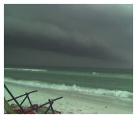
 A huge group of thunderstorms has been slowly traveling from the Atlantic Ocean to the Gulf coast region of the United States over the past couple of days. According to a statement posted on the National Weather Service Website on Thursday, weak low pressure has been created off Florida’s Gulf Coast. KBTV meteorologist Andrew Chung states that, though the low pressure system had not moved to a considerable extent on Thursday, it is expected to do so in the near future. He also added that, “What we're thinking is it will start to move off to the northwest over the next couple of days.” Currently conditions are favorable for the system to develop into a subtropical or tropical storm within the next few days as it moves west-northwest. All Gulf States i.e. Texas, Louisiana, Alabama, Mississippi, and Florida, have been advised to monitor the system closely. Storms are created when a center of low pressure develops, with a system of high pressure surrounding it. This combination of opposing forces can create winds and result in the formation of storm clouds. Small, localized areas of low pressure can form from hot air rising off hot ground, resulting in smaller disturbances such as whirlwinds. Certain strips of heavy storm activity have been forming to the north and have begun to hit the Florida Panhandle. Florida Panhandle is the region of the state of Florida which includes the westernmost 16 counties. It lies between Alabama & Georgia to the north and the Gulf of Mexico to the south. According to reports obtained from the National Hurricane Centre, the low pressure area which resulted in rainfall at the Tampa Bay was around 115 miles west of Tampa, a city which sits on the west coast of Florida. Chung stated that the storm system has not yet converted into a “warm core” system, but could do so once it begins to travel over the gulf. This is due to the high water temperatures which would help the nascent system of storms to grow. This particular system of storms, still waiting to develop in the Gulf of Mexico, is taking quite some time to consolidate itself. "The bottom line is the thunderstorms are still disorganized," Chung stated, "Wait and see and stay tuned." This scenario is quite a contrast to the hurricane Humberto, which developed into a category 1 hurricane almost overnight. It intensified faster than any other tropical cyclone on record within 18 hours of landfall. Chung said that computer models indicate the high probability of this particular system of storms making landfall on the Central Gulf Coast on Saturday. Its path could begin from Pensacola, Florida and would continue along the Louisiana coastline. Pensacola is sea port on the Pensacola Bay, which connects to the Gulf of Mexico. Another model indicates that the storm’s path would begin in Louisiana and head towards Jasper. KFDM meteorologist Greg Bostwick has predicted that the storm, if fully developed, would make landfall on the Texas coast. He also adds that the threat of destruction and severity would be quite low if the storm develops itself comfortably. "If it doesn't develop by tomorrow, it's probably not going to be much of a big deal," Bostwick said. According to Bostwick, upper level winds are hampering the storm’s development. As a consequence, the storm would be rendered to a mere tropical one. According to spokesman Jimmy Nunn, Computer models developed by the National Weather Service predict that the storm would make landfall between Southeast Louisiana and Mobile, Alabama, on late Friday or early Saturday. Oil companies in the Gulf have begun to extract their employees from offshore drilling operations. According to a press release from Shell media relations, Shell Oil has retracted its 1000 workers from such operations. The Beaumont Police Department has issued a list of precautions and measures to be taken. This includes stocking up on prescriptions, water, ice, and non-perishable foods. Natives are advised to review an evacuation plan for themselves and their families. They are also instructed to keep battery-operated radio sets and ice-chests handy. Also, residents must pay attention to the latest news on storm activity in the Gulf of Mexico. David Caplan, spokesman for Entergy Corporation, Texas, states that he is a "little more encouraged" that the storm likely will not affect Southeast Texas, though the utility remains ready to respond. Entergy Corporation is an integrated energy company engaged primarily in electric power productions and retail distribution operations, and functions in Arkansas, Texas, Louisiana, and Mississippi. Entergy Texas restored services in its eastern Texas service area within four days of Hurricane Humberto’s landfall. |
|
||||||
Disclaimer: The views and investment tips expressed by investment experts on themoneytimes.com are their own, and not that of the website or its management. TheMoneyTimes advises users to check with certified experts before taking any investment decision. ©2004-2007 All Rights Reserved unless mentioned otherwise. [Submit News/Press Release][Terms of Service] [Privacy Policy] [About us] [Contact us] |